Stewart Island

Find Businesses and Services in Stewart Island, Stewart Island
Please select your preferred Industry:
- Stewart Island Accommodation
- Stewart Island Arts & Entertainment
- Stewart Island Sports & Leisure
- Stewart Island Travel & Tourism
Add a Business to Stewart Island
Map of Stewart Island
Featured Businesses
Aurora Charters2009-03-16
Located in Stewart Island, Foveaux Strait, Stewart Island, New Zealand
 Imagine cruising through crystal clear waters, taking in the spectacular views of Rakiura National Park. Walk through native bush and listen to the song of native birds all around...You can do all of this with Aurora Charters, Stewart Island, New Zealand.READ MORE
South Sea Hotel2009-03-15
Located in Stewart Island, Foveaux Strait, Stewart Island, New Zealand
 The staff of the South Sea Hotel in Stewart Island, New Zealand can advise you on local attractions and activities and help you with your booking. When you arrive onto the island, either by ferry or plane, the hotel is only a 3 minute walk away. READ MORE
Featured Businesses
Rakiura Lodge2009-03-15
Located in Stewart Island, Foveaux Strait, Stewart Island, New Zealand
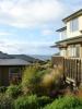
 Rakiura Lodge, Stwart Island, New Zealand offers high quality self-catering accommodation for up to 8 people. Stewart Island offers a wide range of activities including fishing and tramping. Much of Stewart Island forms Rakiura National Park, New Zealand's newest national park, and includes many areas of stunning natural beauty.READ MORE
Greenvale2009-03-15
Located in Stewart Island, Foveaux Strait, Stewart Island, New Zealand
 Greenvale Bed and breakfast, Stewart Island, New Zealand is the ideal location for visitors who wish to relax while taking in the stunning surroundings or for those who wish to be close to all that is on offer on Stewart Island.READ MORE
Glendaruel Bed and Breakfast2009-03-15
Located in Stewart Island, Foveaux Strait, Stewart Island, New Zealand
 You won't find High Rise Hotels, Casinos, Shopping Malls and the like but most of visitors to Glendaruel Bed and Breakfast, Stewart Island, New Zealand enjoy a rest from these 'pleasures' of civilisation and adjust easily to the slower pace of life which prevails here. The Island is the way New Zealand used to be and we invite you to meet us as we are. Enjoy your visit !READ MORE
Rakiura Kayaks2009-03-16
Located in Stewart Island, Foveaux Strait, Stewart Island, New Zealand
 Stewart Island is New Zealand's southern most inhabited island. It is home to a unique range of wildlife from the 4 ton Elephant Seals to the elusive kiwi. The scenery is spectacular and diverse, with beautiful beaches, granite peaks, rainforests, one of New Zealand's most extensive sand dune systems. Contact Rakiura Kayaks, Stewart Island, New Zealand for a day packed with adventure!READ MORE
The Bach2009-03-16
Located in Stewart Island, Foveaux Strait, Stewart Island, New Zealand
 The Bach, Stewart Island, New Zealand is located up on a hill at the end of the road, nestled in native bush. Wake up to bird song, and unwind...READ MORE
Tokoeka Bed and Breakfast2009-03-16
Located in Stewart Island, Foveaux Strait, Stewart Island, New Zealand
 Tokoeka Bed and Breakfast is very scenically situated in the main village of Halfmoon Bay, Stewart Island, New Zealand. It overlooks the Tokoeka Gardens, the Village and Bay and out to the Foveaux Strait waters. Every room enjoys wonderful Garden,Village and Ocean views READ MORE
Port of Call2009-03-16
Located in Stewart Island, Foveaux Strait, Stewart Island, New Zealand
 Your hosts Philippa and Ian welcome you to their home - Port of Call, Stewart Island, New Zealand. They operate a unique, quality Bed and Breakfast in their relaxed and tastefully decorated home overlooking Halfmoon Bay and Foveaux Strait. READ MORE
Glendaruel Bed & Breakfast
Located in Stewart Island, Foveaux Strait, Stewart Island, New Zealand
 Visit Glendaruel Bed & Breakfast in Stewart IslandREAD MORE
Stewart Island Lodge2009-03-15
Located in Stewart Island, Foveaux Strait, Stewart Island, New Zealand
 From Stewart Island Lodge in Stewart Island, New Zealand there are sweeping views of the gardens and ocean beyond, providing an idyllic place for contemplation and relaxation. During cooler weather, relax in the private guest lounge beside the cosy open fire. Stewart Island is New Zealand's third-largest island.READ MORE
Bay Motel2009-03-15
Located in Stewart Island, Foveaux Strait, Stewart Island, New Zealand
 The Bay Motel in Stewart Island, New Zealand is located right in the centre of Halfmoon Bay within easy walking distance of all amenities: shops, restaurants, post office, gym, museum, information centre and booking office.READ MORE
Margaret Fairhall2009-03-16
Located in Stewart Island, Foveaux Strait, Stewart Island, New Zealand
 Margaret Fairhall from Stewart Island, New Zealand has painted most of her life and her artwork has found its way into many parts of the world. She takes on commission work and is a regular participant in exhibitions.READ MORE
Aihe Eco Charters and Water Taxi2009-03-16
Located in Stewart Island, Foveaux Strait, Stewart Island, New Zealand
 Aihe Echo Charters and Water Taxi operates in Stewart Island, New Zealand waters providing small group charters and cruises, sightseeing, sea bird watching, wildlife viewing and guided tours with natural history and cultural history interpretation. A marine mammals viewing permit is currently pending.READ MORE