Mount Gambier

Find Businesses and Services in Mount Gambier, South Australia
Map of Mount Gambier
Featured Businesses
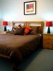
Apartments on Tolmie
Located in Mount Gambier, Limestone Coast, South Australia, Australia
 Visit Apartments on Tolmie in Mount GambierREAD MORE
The Garden Retreat2009-09-15
Located in Mount Gambier, Limestone Coast, South Australia, Australia
 The Garden Retreat at Amble Inn located in Mount Gambier in South Australia offer a Luxurious One Bedroom Apartment close to Main Shopping Area, Cafes, Pubs, Clubs, Theatre. READ MORE
Featured Businesses
Bullfrogs Cafe, Bar and Grill2009-09-15
Located in Mount Gambier, Limestone Coast, South Australia, Australia
 Bullfrogs Cafe, Bar and Grill where you can relax in Mount Gambier offer a Cafe, Bar and Grill serving Lunches of focaccias, salads, beef burgers, antipasto, pastas., locally produced wines, Premium beers and Bullfrog cocktail can be enjoyed at the venue. Birthdays & engagement parties, private and business dinners. READ MORE
Arkana Motel and Terrace Apartments 2009-09-15
Located in Mount Gambier, Limestone Coast, South Australia, Australia
 Arkana Motel and Terrace Apartments have standard single rooms through to deluxe 2 bedroom self contained units with spa baths and offers modern, well appointed standard, executive and family rooms in Mount Gambier. READ MORE
Amble In Bungalow2009-09-15
Located in Mount Gambier, Limestone Coast, South Australia, Australia
 Amble In Bungalow in Mount Gambier in South Australia is a self contained bungalow with a fully equipped kitchen and private Lounge, two bedrooms and bathrooms and sleep up to 6 guests. Pets allowed outside. READ MORE
ANDERSON STREET APARTMENTS2009-09-14
Located in Mount Gambier, Limestone Coast, South Australia, Australia
 Centrally located in the CBD of Mount Gambier the Anderson Street Apartments offer long and short stays with corporate and weekend rates with free standing 2-3 bedroom apartments with open plan living. The 4 apartments are fully self contained, with a private courtyard. READ MORE
The Lakes Resort 2009-09-14
Located in Mount Gambier, Limestone Coast, South Australia, Australia
 The Lakes Resort located above the Valley Lake in the beautiful Blue Lake city of Mount Gambier caters for functions, conferences, wedding receptions, pre-Christmas functions and Private dinners. Accommodation is offered in deluxe suites and executive suites. The on site A la carte restaurant serves local produce. READ MORE
Amble In Cottage2009-09-15
Located in Mount Gambier, Limestone Coast, South Australia, Australia
 Amble In Cottage in Mount Gambier offer a 2 Bedroom Cottage on a farm location near Glenelg NP. The cottage sleep 5 with an fully equipped kitchen and BBQ facility. READ MORE
Sturt Street Apartments2009-09-14
Located in Mount Gambier, Limestone Coast, South Australia, Australia
 Sturt Street Apartments in Mount Gambier offer long or short stays, corporate and weekend rates. Long or short term accommodation is available in free standing 2 or 3 bed apartments with open plan living areas. READ MORE
Kalganyi Holiday Park 2009-09-14
Located in Mount Gambier, Limestone Coast, South Australia, Australia
 Kalganyi Holiday Park is located in Mount Gambier and offer numerous park accommodation options including disabled access sites. Free Recreation Facilities and Free Barbeque Facilities as well as Camp Kitchen and Heated Swimming Pool. READ MORE
The Barn Palais and Catering Service 2009-09-15
Located in Mount Gambier, Limestone Coast, South Australia, Australia
 The Barn Palais and Catering Service offers flexibility and character, together with fine food, great wines and a lush rural setting, making it the ideal venue for weddings, meetings, banquets, conferences and special events.READ MORE
Triune House Self Contained Hosted Apartments2009-09-14
Located in Mount Gambier, Limestone Coast, South Australia, Australia
 Triune House Self Contained Hosted Apartments is situated in central Mount Gambier - with its famous Blue Lake and world listed caves, Beachport, Robe, Coonawarra wine region, Nelson, Portland, Naracoorte Caves are nearby attractions. The apartments offer outdoor entertainment with BBQ, kitchen and jacuzzi with 3 bedrooms. READ MORE
Mid City Motel and Apartments 2009-09-14
Located in Mount Gambier, Limestone Coast, South Australia, Australia
 Mid City Motel and Apartments located in Mount Gambier offer corporate rates and weekend rates for their 2 bedroom units, self contained, and family rooms. The hotel also offers apartment accommodation in the Sturt and Anderson Streets. READ MORE
Jubilee Motor Inn2009-09-15
Located in Mount Gambier, Limestone Coast, South Australia, Australia
 Jubilee Motor Inn in Mount Gambier is close to attractions in the area including the world-renowned Blue Lake, the wine region of Coonawarra, the World Heritage-listed Naracoorte Caves National Park, and the historic seaside port of Robe. READ MORE
Eliza Cottage2009-09-14
Located in Mount Gambier, Limestone Coast, South Australia, Australia
 Eliza Cottage Bed and Breakfast in Mount Gambier is a self-contained heritage cottage with country kitchen and garden located close to the local wine regions. READ MORE
Bertha Street apartment2009-09-14
Located in Mount Gambier, Limestone Coast, South Australia, Australia
 Bertha Street apartment located in Mount Gambier in South Australia features an open plan living area and 3 bedrooms sleeping up to 6 people.READ MORE
Mount Gambier Serviced Apartments2009-09-14
Located in Mount Gambier, Limestone Coast, South Australia, Australia
 Mount Gambier Serviced Apartments have 12 quality properties for you to choose from and can accommodate groups of up to 12 people in Mount Gambier in South Australia.
READ MORE
Mount Gambier Serviced Apartments have 12 quality properties for you to choose from and can accommodate groups of up to 12 people in Mount Gambier in South Australia.
READ MOREAvalon Motel 2009-09-14
Located in Mount Gambier, Limestone Coast, South Australia, Australia
 The Avalon Motel is set in a quiet yet central location in Mount Gambier and offers various accommodation options: Apartment, sleeps 8, Deluxe Family Unit, sleeps 6, Deluxe Rooms, sleeps 3, Standard Rooms, sleeps 3 and economy rooms with double beds. Blue Lake, volcanoes, caves, sinkholes, gardens and outstanding heritage buildings are some attractions of the town. READ MORE
Lemon Gum Bed and Breakfast 2009-09-15
Located in Mount Gambier, Limestone Coast, South Australia, Australia
 Lemon Gum Bed and Breakfast can be found in Mount Gambier and offers accommodation for 4 people and is half an hour from the beach, the Glenelg River, the Coonawarra wine region, and heritage listed caves.READ MORE
MG Delux Apartment 2009-09-15
Located in Mount Gambier, Limestone Coast, South Australia, Australia
 MG Delux Apartment located in Mount Gambier is an executive apartment with 3 bedrooms and an office, and sleeps up to 7 people.READ MORE
Quality Inn International Motel2009-09-15
Located in Mount Gambier, Limestone Coast, South Australia, Australia
 Quality Inn International Motel located in Mount Gambier offer 60 motel rooms, family rooms and deluxe rooms. Motel facilities include heated pool, spa & sauna, tennis court, playground, Restaurant and Bar. The motel caters for functions up to 250 guests and for conventions, conferences and training days for up to 110 conference goers. READ MORE
>
>
>
>
>
>
>
>